Maacama Creek
District WatershedWatershed Overview
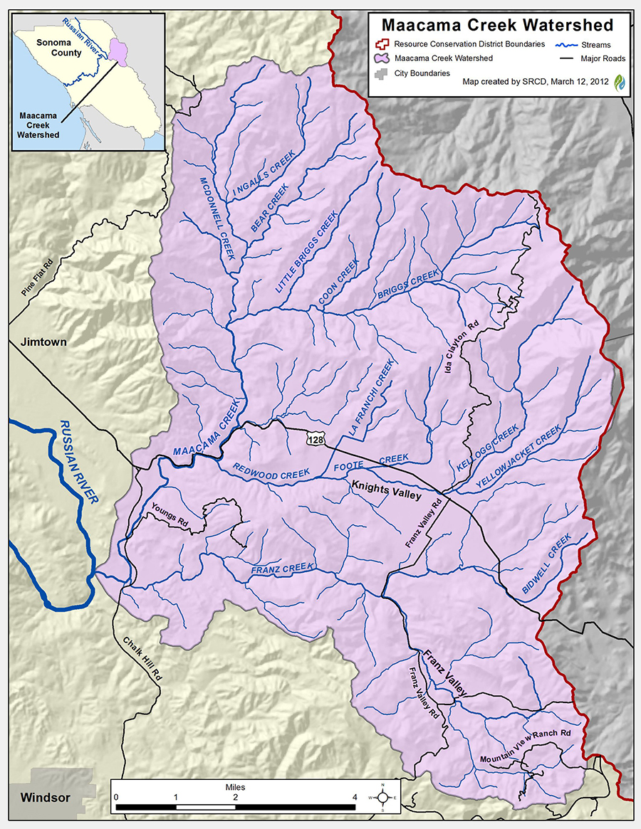
Maacama Creek and its tributaries drain a basin of approximately 69.7 square miles and is composed of 7 sub-basins including: McDonnell Creek, Briggs Creek, Kellogg Creek, Maacama Creek, Bidwell Creek, Upper Franz Creek, and Lower Franz Creek. The confluence of Maacama Creek and the Russian River is about 3 miles East of Fitch Mountain, or about 4.5 miles east of the City of Healdsburg.
Land Use
Major land use is agricultural with vineyards and cattle ranching and rural and residential properties. Knights Valley and Franz Valley have been in agricultural use focused on vineyards and cattle ranching since the 1860’s. There are no incorporated cities or towns within the boundary and the watershed is about 93% privately owned with about 7% held by either state or federal entities. There are other quasi-private properties held by the Sonoma Land Trust, the Sonoma County Agricultural and Preservation Open Space District and the Audubon Canyon Ranch than have limited opportunities for public access.
Vegetation
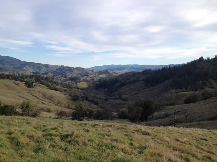
The landscape is characterized by a mosaic of different habitat types including chaparral, coniferous forest, hardwood forests, grasslands and riparian habitat with elevations ranging from 4,343′ at Mt. Saint Helena Peak to 140′ at the confluence of Maacama Creek and the Russian River. Highway 128 runs through Knights Valley which is the main point of access in the watershed. Knights Valley boasts great vistas of Mt. Saint Helena, local vineyards and is rich with history.
Fish and Wildlife
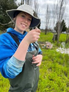
Coho Salmon (Oncorhynchus kisutch) and steelhead (Oncorhynchus mykiss) are present in the Maacama Watershed. There was an exciting discovery in the fall of 2011 when wild Coho Salmon were observed by the Department of Fish and Game during a snorkel survey. Wild coho had not been observed in the watershed since 2001. Steelhead are present in limited numbers throughout the watershed. Actions to improve habitat for coho and steelhead are focused on increasing riparian habitat to improve water quality and temperature, removing migration barriers, creating more instream habitat and reducing sediment in the stream system.
In addition to salmonids, there are other endangered and threatened species that have been located within the watershed including Syncaris pacifica (CA freshwater shrimp), Rana draytonii (CA red-legged frog) and Rana boylii (yellow- legged frog).
Current and Past RCD Programs
- The RCD has worked with many agricultural producers in Maacama Watershed to enhance their farming operations and protect soil and water resources. Projects include the development of LandSmart Plans, implementation of frost protection alternatives, enhancement of riparian areas, erosion control, and hedgerow plantings.
Watershed Scale Planning
- Maacama and Mark West Integrated Watershed Management Plan – View & Download PDF: The RCD is developing a comprehensive Integrated Watershed Management Plan for the Upper Mark West and Maacama Creek Watersheds. This plan will integrate and update the draft Upper Mark West Management Plan and the completed Maacama Watershed Plan. To complete this plan, the RCD is working with landowners and other stakeholders throughout the watershed to investigate and evaluate current and historic conditions and recommend a prioritized set of actions and programs to improve water quality and riparian and aquatic habitat conditions. This effort builds off of the RCD’s completion of the Maacama Watershed Assessment in 2005.
Water Resource Management
- As one of our district’s major winegrowing areas, and as an area where water conservation has been deemed a high priority, Maacama is one of the focal areas of our Vineyard Irrigation Evaluations. This service is currently available on a fee for service basis.
On-the-Ground
- To mitigate for impacts of two bridges CALTRANS replaced along Hwy 128 in 2010, the Bidwell Creek Riparian Enhancement Project was developed and identified for implementation by the RCD. This project which, will start implementation in the winter of 2016-17 will install two hundred (200) riparian trees and shrubs along 930 feet of Bidwell Creek, a salmonid bearing stream.
- The RCD is actively working with landowners to develop and implement projects to enhance riparian and instream habitat and stabilize eroding stream banks.
- As part of the Rural Road Improvement Program the RCD is currently working with landowners to assess unpaved roads to identify sites posing a risk of sediment delivery to nearby streams.
- The RCD continues to implement projects identified through outreach and stream assessments in the “Habitat Restoration and Conservation Plan for Anadromous Salmonid Habitat in Selected Tributaries of the Russian River Basin” in Alexander Valley, Dry Creek Valley, and Knights Valley.
Links to Important Programs in the Watershed
Sonoma County Agricultural Preservation and Open Space District
Audubon Canyon Ranch
Sonoma Wine Grape Commission/Knights Valley
Sonoma Land Trust
Audubon Canyon Ranch
Pepperwood Preserve
National Oceanic and Atmospheric Administration, National Marine Fisheries Service
Natural Resources Conservation Service
Partners for Fish and Wildlife Program
United States Army Corps of Engineers
United States Department of Agriculture
United States Environmental Protection Agency
United States Fish & Wildlife Service
California Coastal Conservancy
California Department of Fish and Wildlife
California Regional Water Quality Control Boards, North Coast Region
California State Water Resources Control Board
University of California Cooperative Extension
Sonoma County Agricultural Preservation and Open Space District
Sonoma County Department of Transportation and Public Works
Sonoma County Permit and Resource Management Department
Sonoma County Public Health Division
Sonoma County Regional Parks Department
Sonoma County Water Agency
Sonoma County Agricultural Commissioner
San Francisco Bay Regional Water Quality Control Board
Sonoma County Farm Bureau
Sonoma County Farm Trails
Sonoma County Winegrape Commission
Sonoma Land Trust
California Waterfowl Association
Community Alliance of Family Farmers

