RCD Reports
Annual Reports and Strategic PlanStrategic Plan 2021 – 2024
The purpose of this Strategic Plan is to guide the RCD’s high-level decisions for the next three years. Our approach with the Plan was not to identify every activity the RCD will carry out in service to our mission, but rather to identify the greatest opportunities to grow and improve how we deliver on that mission.
Annual Report 2021-2022
The past year has been eventful as ever. Our team celebrated both professional milestones and personal adventures. We said bittersweet goodbyes and joyfully welcomed new staff and board members. And true to form, we accomplished important conservation outcomes on the ground and in our community. The pages of this report reflect some of our major strategic efforts over the past year: expanding our reach in the community, helping build resilience across the landscape, and leveraging farms to fight climate change. Thank you for your partnership and commitment to local conservation.


Resources
Publications and Informational VideosTechnical Conservation Videos
Visit our YouTube channel for our full video lineup.
Post-Fire Gully and Headcut Repair Demonstration Project – Pepperwood Preserve
This video was created to demonstrate five different types of headcut and gully repair erosion control practices in a post-fire landscape that landowners can potentially do themselves on their own properties. This demonstration project was funded through the State Water Resources Control Board’s 319h Grant program and took place in September 2022 at the Pepperwood Preserve Property in Santa Rosa, California. Sonoma Resource Conservation District designed and oversaw the implementation of the project with assistance from Prunuske Chatham Inc. The project was constructed by Spye General Engineering. https://www.youtube.com/watch?v=4w_ucfgvuZs&t=4s
Time codes for each of the five headcut treatments are listed below:
Table of Contents: 0:00
– Introduction 2:31
– Overview of Pepperwood Preserve 3:53
– Site 1: Willow Wall with Willow Mattress treatment 11:29
– Site 2: Loose Rock Headcut Repair 17:08
– Site 3: Rock Grade Control Structure with Check Dam 20:12
– Site 4: Native Grass Plantings 22:06
– Site 5 – Brush Rows to Brush Check Dam 26:46
– Acknowledgments
The Groundwork Erosion Control Guide referenced in the introduction can be downloaded here: http://www.marinrcd.org/wp/wp-content…
A timelapse video of the 5 different treatments can be viewed here: https://youtu.be/NqUpkaWHyT0
Coastal Rainwater Catchment and Forbearance Project
The first is a brief video highlighting the Sonoma County Coastal Rainwater Catchment and Forbearance Project, funded by California Wildlife Conservation Board and managed by Sonoma RCD.
The second is a brief video covering the basic operation and maintenance of typical rainwater catchment systems. This video was produced as part of the Sonoma County Coastal Rainwater Catchment and Forbearance Project, funded by California Wildlife Conservation Board.
https://www.youtube.com/watch?v=boyUkU_TocU&t=2s
Please view or download our Operation and Maintenance Document for rainwater catchment systems below:
Typical Rainwater Catchment Operation & Maintenance Guidance
Rolling Dip Timelapse
View video on YouTube
This is a timelapse video of a road drainage feature called a rolling dip. Rolling dips are used to help roads drain more efficiently and to disconnect road surface runoff from draining directly to streams, thus improving the longevity of the road and reducing road related sediment from entering nearby waterways. This was a part of a larger project implemented on a ranch in Sonoma, CA and funded by the State Coastal Conservancy and the State Water Resources Control Board. Sonoma RCD managed both grants and worked with Campbell Grading to implement the road work. Note that both a bulldozer and an excavator where used for this particular rolling dip, but the work can also be done using only a bulldozer.
Armored Fill Timelapse
View video on YouTube
This video shows a timelapse of the construction of an armored fill crossing in Sonoma, CA. The Sonoma RCD project was funded by a combination of grants from the CA State Coastal Conservancy and the State Water Resources Control Board, as well as landowner cost-share.
Publications and Resources
Groundwork
A handbook for small-scale erosion control in Coastal California.
Compost Resources Fact Sheet
This fact sheet covers it all on compost – what is it, how it can be beneficial, where to source it from, how to get it on site, and more! Compost is the final poduct of a managed thermophilic process through which microorganisms break down organic materials into forms suitable for beneficial appliation o the soil. A well-managed composting pocess has plenty of oxygen, goes through a high-heat phase that accelerates the natural biodegradation of oganic materials and produces a stable form of organic mater that is made up of carbon and nitrogen, contains other important nutrients, and is free of weed seeds and harmful pathogens. Compost is a more complex and stable material than aged manure, mulch, or other organic materials used for agricultural purposes.
Tending the Edges: The Benefits of Hedgerows on Bay Area Working Lands
Tending the Edges illuminates some of the benefits of hedgerow plantings, describes related conservation practices, and provides resources for land stewards to get started planting. While this publication focuses on Marin County, many of the concepts are applicable to other Bay Area regions. This publication was created by the Marin Resource Conservation District (Marin RCD), with grant funding from the California Wildlife Conservation Board and the California Department of Food & Agriculture. Printed copies in English and Spanish are now available at our office!
Water Storage Tank Best Management Practices for Wildfire Resilience
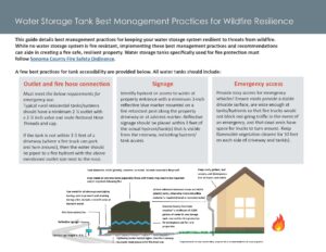 This guide details best management practices (BMPs) for keeping your water storage system resilient to threats from wildfire. While no water storage system is fire resistant, implementing these best management practices and recommendations can aide in creating a fire safe, resilient property. Water storage tanks specifically used for fire protection must follow Sonoma County Fire Safety Ordinance.
Information compiled and presented by Sonoma Resource Conservation District. Funding to produce this document was provided by the Sonoma County Vintners Foundation. Project partners providing information and review include CAL FIRE and Permit Sonoma.
Coastal Rainwater Catchment and Forbearance Project
The first is a brief video highlighting the Sonoma County Coastal Rainwater Catchment and Forbearance Project, funded by California Wildlife Conservation Board and managed by Sonoma RCD.
The second is a brief video covering the basic operation and maintenance of typical rainwater catchment systems. This video was produced as part of the Sonoma County Coastal Rainwater Catchment and Forbearance Project, funded by California Wildlife Conservation Board.
https://www.youtube.com/watch?v=boyUkU_TocU&t=2s
Please view or download our Operation and Maintenance Document for rainwater catchment systems below:
Typical Rainwater Catchment Operation & Maintenance Guidance
Typical Rainwater Catchment Operation & Maintenance Guidance
View & Download PDF
The RCD’s Typical Rainwater Catchment Operation and Maintenance Guidance.
Permitting for Conservation Projects
View & Download PDF
The RCD’s simple one page guide for landowners on permits needed for a variety of conservation projects.
Planning and Permitting Forest Fuel-Reduction Projects on Private Lands in California
The Planning and Permitting Forest Fuel-Reduction Projects on Private Lands in California guide was developed with funding support from the North Coast Resource Partnership and the California Fire Science Consortium. The new publication can be found https://anrcatalog.ucanr.edu/pdf/8716.pdf and is available for free download.
This publication presents some key considerations and insights into selecting the appropriate permit to facilitate fuel-reduction projects on private lands—and offers insights into permitting larger fuel projects that involve multiple owners or multiple funding sources. The publication is organized around projects that take place before or after wildfires. It is intended for foresters, private owners of both small and large parcels of land, natural-resource professionals, and project developers. The publication includes decision trees to help landowners and resource managers crosswalk projects to permits.
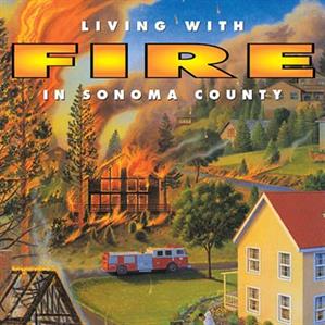
Living with Fire in Sonoma County
View & Download PDF
Much of Sonoma County is considered a high hazard fire environment. Research clearly demonstrates that pre-fire activities save lives and property.
California Native Plant Society Fire Recovery Guide
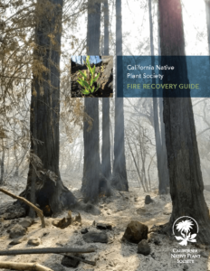
What should you do with your land after a wildfire?
The CNPS Fire Recovery Guide addresses that question in an easy-to-use booklet, created in response to the widespread Wine Country fires. The Guide is a collaborative effort between CNPS, North Bay partner organizations, and some of the best fire experts in the state.
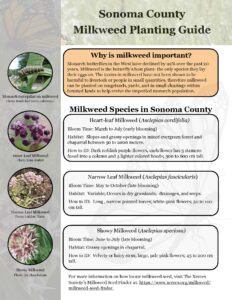
Milkweed Planting Guide for Sonoma County
 View & Download PDF
A guide to milkweed planting and its importance to the monarch butterfly.
Water Wise Pollinator Habitat Plant Chart for the North Coast
View & Download PDF
The plants in this chart are capable of providing multiple benefits to pollinators. Attractive blooms, nectar and pollen resources, and structural habitat elements of these plants can support the life cycles of bees, butterflies, birds, beetles, bats, and more. To be mindful of drought conditions on the North Coast, most of the plants chosen to be included on this list usually require little to no irrigation once established. Strategically plant these species to enhance beauty and habitat in a working landscape or garden.
Arundo - A Landowner Handbook
View & Download PDF
A guide to Arundo, an invasive non-native plant that is taking over streams across California and tools to managing it on your property. Produced by the Sonoma Ecology Center and CSU Sacramento, Media Services in 1999.
Programs, Services and the Latest Science for Vineyard Owners
View & Download PDF
The Sonoma County RCD’s have assembled a single reference guide for all services tailored to local vineyard operations.
View & Download PDF
Vineyard Irrigation System Toolkit
Tillage Impacts on Soil Health and Water Retention – Summary of a Sonoma Valley Vineyard Field Trial
There is spirited, ongoing debate on how to best manage tillage in vineyard tractor rows. Proponents and practitioners of full till, no till or alternate row tillage all make good arguments, often with great passion. The “best tillage” for a site might depend on soil, slope, or management needs, but pertinent questions remain:
- What is the best management to retain moisture in the soil?
- Can water be conserved through a specific type of tillage management?
- Which management is the best for soil health and ultimately grape production and quality?
Proponents of tillage see it as a necessary tool to diminish competition for water and nutrients, and to control weeds. Those who favor no till argue that it improves soil structure and increases organic matter, which improves soil health and water retention. Many argue that alternate row management provides the best intermediary solution – a tilled row to manage inputs and fertility and a non- tilled row to access vines in winter and spring, and reduce impacts and costs associated with tillage. With these questions and considerations in mind, and a desire to get more answers based on data versus observation, or a growers’ sense of what is best management, the Sonoma RCD secured a NRCS grant in 2016 to do a field trial at a working vineyard in Kenwood. We partnered with John MacLeod of MacLeod Family Vineyards, who shared interest in these questions as a long-time grower and retired environmental geologist. Soil scientist Dr. Josh Beniston, head of the Santa Rosa Junior College (SRJC) Sustainable Agriculture program, was brought on board as the project scientist. Dr. Mark Greenspan, President of Advanced Viticulture, joined the effort as a consultant assisting with soil moisture tracking and analysis.
In late December 2016, we walked the MacLeod vineyards and Dr. Beniston identified a suitable portion of the ranch with relatively uniform soil and slope. We designed a field study, creating 9 plots in close proximity within a head trained zinfandel block. Each plot consisted of a 100-foot stretch that encompassed one vinerow and two adjacent tractor rows. Each type of tillage (full till, no till, and alternate row till) was repeated across 3 plots to make 9 total plots in the study area. The rough, gravely, volcanic soil at the site was determined to be a Laniger loam soil series.
Soils were sampled in spring of 2017 to measure properties useful for gauging soil health: soil texture, carbon content, soil organic matter, active carbon, bulk density and wet aggregate stability. In each plot, samples were taken at the 0-10 cm (0-4”) and 10-20 cm (4-8”) depths within the tractor row on both sides of the vinerow. Samples were taken from the middle of the tractor rows to avoid the area where tractor wheels compact the soil. Each sample was a composite of 3-4 subsamples taken across each plot. They were sent to the Oregon State University Soil Lab for analysis, while bulk density was measured at SRJC. These lab results provided a baseline for comparison of data from the 2019 soil sampling, which followed two and a half years of maintaining the tillage treatments.
In fall 2017, the tillage treatments were officially implemented using a standard wheel disc. LeBallister’s OSB Plowdown mix was seeded in tilled areas of the plots at a 50# per acre rate. Resident vegetation was allowed to grow in untilled rows. Each plot was managed in its designated tillage regime for the duration of the trial, through fall 2019, with standard mowing in winter and spring, and tillage in spring and fall. Alternate rows were flipped each spring. The OSB plowdown mix was planted again in tilled areas in fall of 2018 at 50# per acre.
In December of 2017, Aquacheck soil probes were installed in the center of the vinerows in all plots, allowing us to track relative moisture levels in 8” intervals every 30 minutes. Probes went to a depth of 2.5-4 feet deep, depending on the depth of the soil in the plot. Every 2-4 weeks, the moisture data was recorded with a field logger and uploaded to the Aquacheck web software. This allowed us to graphically view the data in a comprehensible format.
Plots were maintained as specified for the study through fall 2019, when we repeated the soil sampling.
What did we find?
Soil Analysis
Analyzing soil sampling results, 2 tests showed statistically significant differences: soil carbon content and wet aggregate stability. Total carbon (which is half of soil organic matter levels) measured 13% higher in the no till plots versus the tilled plots in the top 4 inches. It was 2.33% for no till, 2.02% for tilled, and 2.25% for alternate row tillage plots. Total carbon at the 4 to 8 inch (10-20 cm) depth did not demonstrate measurable differences across tillage treatments.
Wet aggregate stability is a laboratory measurement that looks at the ability of the soil’s structure or aggregates to hold together under a heavy rainfall event. Full tillage reduced wet aggregate stability (WAS) by 24% at the 0-4 inch depth. No till measured 18.5% total WAS, tilled plots were 14.1% and alternate row measured 19.8%.
It is important to note that tests only reflected 2.5 years of specific tillage management approaches, which is a very short time period for seeing changes in soils. Changes in management are more likely to be seen in a 5-10 year timeframe, and longer is better. While it would be good to have more time, these results reflect a somewhat significant difference over a relatively short time frame.
Other soil tests did not demonstrate a clear difference among the different tillage treatments. Active carbon is a measure of the readily available carbon for plant and organism consumption. Bulk density reflects the amount of pore space and compaction in soil. Measured soil properties were used to estimate the plant available water holding capacity of the soil using a USDA hydrology model. None of the results for these soil health parameters demonstrated significant differences from impacts of the three tillage management practices during the study in the top 8” of soil.
The most notable result from our soil analysis is that we saw a 13% difference in soil carbon after a relatively short timeline (2.5 years). Dr. Beniston points out that the soil carbon also provided the most consistent measurements of different soil health parameters tested in this study. The results also suggest that alternate row management aligns closer to no till (than full tillage) in its ability to sustain soil health. Ideally, we would have more repetitions of each management approach and more time to gain additional insights on management implications for soil health, but our initial results suggest that soil health and soil carbon were better supported by no till and alternate row management, compared with full tillage.
Soil Moisture Analysis
A commonly quoted statistic is that each 1% increase in organic matter in the soil increases water retention by an additional 20,000 gallons/acre to 27,154 gallons/acre (1 acre inch). Did we see greater water retention in the no till or reduced till plots? To answer this, Dr. Greenspan analyzed the massive data set of soil moisture readings to determine average depletion rates of soil moisture for the different tillage management regimes. He focused on the spring/early summer moisture drawdown rates at the 1 and 2 foot (30 and 60 cm) levels. This is the time when growers decide when to start irrigating, or not, and those decisions have the greatest potential for water conservation. It is also the time in the North Coast when rain-fed moisture is being depleted before being supplemented by irrigation, and the cover crop is most active, and therefore, influential on soil moisture levels. The spring/early summer drawdown provided the most meaningful and clear data to analyze, especially in 2019. The summary of this analysis is below, with the cells highlighted in green reflecting the lowest, most favorable depletion rates.
Depletion rates (in percent relative water content per day) for three treatments, averaged across three plots each and over two time periods for each year. The lowest of the depletion rates for each time period are shaded in green.
While the results didn’t show statistically significant differences, some trends can be observed with some notable differences at the one and two foot levels. The full till plots showed a higher level of water loss in the upper foot (0-30 cm) but lower in the deeper foot (30-60 cm) than no till plots. Conversely, the no till plots had lower water loss in the upper foot and greater water loss in the lower foot than full till. While this field study did not provide enough clear data to make a decisive conclusion about this question, Dr. Greenspan thinks the disturbance of tilling in the upper foot creates increased evaporation in this zone. However, it also disrupts or fills in the evaporation channels in the lower foot. Thus, tilled areas retained more water at the lower foot, though the differences were not significant.
The alternate row managed plots behaved somewhere in between the tilled and untilled plots. In early spring, alternate row plots lined up closer to full till in the upper foot and somewhere in between full till and no till in the lower foot. In later spring, the alternate till plots behaved more like no till in the upper foot and full till in the lower foot.
Looking at both years and depths combined, we do not see much difference in soil moisture depletion rates between the treatments.
While it would be nice to see more conclusive data, it is hard to expect that in the short time span of a 2.5 year field trial. That said, it is important to point out that this study helps illuminate the potential for reducing or eliminating tillage. If a grower is interested in diminishing tilling, the trial shows us this can be done without negatively impacting water availability to the vines. A producer can gain the benefits of increased organic matter, structure and soil health, as well as reduced time and money for labor and equipment, without having to necessarily sacrifice water availability for the vines. Our results are consistent with the long-term studies conducted by Dr. Patricia Skinkis in the Willamette Valley of Oregon. She found that different tillage management systems can have ranging impacts on nitrogen uptake, but not on soil moisture levels.
There is still much to be learned on the impacts and values of different tillage management systems. The Sonoma RCD has a related ongoing trial on a larger scale at Jackson Family Wines’ Saralee’s Vineyard in Windsor. Other trials are also taking place as part of the North Coast Soil Hub regional effort. To get more details and see our March 13, 2020 Vineyard Soil Health Symposium presentation on the field trial (as well as a talk by Dr. Skinkis), visit the Sonoma RCD website here. You can learn more about soil health, upcoming events, and the North Coast Soil Hub initiative at soilhub.org. You can also contact the project lead Keith Abeles at kabeles@sonomarcd.org
Vineyard Frost Protection, a Guide for Northern Coastal California
View & Download PDF
This RCD and NRCS publication provides a variety of frost protection alternatives available to north coast grape growers.
Slow it. Spread it. Sink it. Store it!
 A Homeowner’s and Landowner’s Guide to Beneficial Stormwater Management
View & Download PDF full guidebook
S4 is now available in a brochure!
View & Download PDF in English
View & Download PDF in Spanish
This manual has been developed for educational purposes by the Sonoma RCD and the Resource Conservation District of Santa Cruz County. The Slow it. Spread it. Sink it. Store it! Guidebook (S4 Guide for short) provides straightforward best management practices that can help to protect and replenish surface water and groundwater resources, offset groundwater use, reduce erosion and pollution, while providing many other benefits.The storm water runoff improvement practices included in this guide are meant to be used as general guidelines and are not to be used as professional engineered specifications.
Traditional building and landscaping practices were designed to dispose of stormwater as quickly as possible. This outdated paradigm typically results in significant damage to land, structures, and the surrounding environment. Slowing down, spreading and sinking stormwater can help protect your property & increase its value, provide a free source of water for irrigation, conserve drinking water, beautify your landscape, promote groundwater recharge and much more!
The guidebook is packed full of information including:
- Understanding and evaluating stormwater runoff around your home or property
- How to protect your property and increase its value
- “Do it yourself” techniques
- A wide assortment of sample stormwater Best Management Practices
- Technical information and advice on rainwater harvesting and infiltration techniques
- Guidance on designing and implementing large-scale projects
- A broad sampling of local projects implemented right here in Sonoma County
- Safety and maintenance requirements
- An extensive resource guide to help readers quickly locate key information and get started!
Supplemental Rainwater Catchment Brochure
View & Download PDF
Condensed information on rainwater catchment techniques and practices from the “Slow it. Spread it. Sink it. Store it!” Guide.
Management Tips to Enhance Land & Water Quality for Small Acreage Properties: Laguna de Santa Rosa Watershed
View & Download PDF
The RCD’s guide includes Best Management Practices for landowners and managers of small acreage properties in the Laguna de Santa Rosa watershed.
The Grazing Handbook
 View & Download PDF
The Grazing Handbook is for public agency personnel and private landowners who may be interested in exploring the use of livestock grazing to further their resource management goals.
Best Management Practices in Outdoor Hog Production
These resource guides on best management practices for outdoor hog production in the San Francisco Bay Area are downloadable from the Alameda County Resource Conservation District and USDA NRCS website.
Horse Manure Management - A Guide for Bay Area Horsekeepers
Equine Facilities Assistance Program Fact Sheets
The Equine Facilities Assistance Program’s goal is to protect San Francisco Bay Area water resources by assisting in effective management of possible non-point source pollutants associated with horses. These informational documents are part of a series prepared and published by the Council of Bay Area Resource Conservation Districts in cooperation with the USDA, Natural Resources Conservation Service and the University of California Cooperative Extension.
Fact Sheet Contents:
- Stormwater Runoff Management at High Use Areas — View & Download PDF
- Composting Horse Manure — View & Download PDF
- Conservation Measures to Reduce Non-point Source Pollution at Horse Facilities — View & Download PDF
- Photographic Monitoring for Equestrian Facilities — View & Download PDF
- Horse Paddocks: Designed and Managed to Protect Water Quality — View & Download PDF
- Controlling Yellow Starthistle — View & Download PDF
- Dryland Pasture for Horses — View & Download PDF
- Horse Manure Management — View & Download PDF
RCD Watershed Assessments, Studies, and Management Plans
SONOMA CREEK WATERSHED
Re-Oaking North Bay
 Re-Oaking North Bay: A strategy for restoring native oak ecosystems, focusing on Napa and Sonoma valleys View and Download PDF
Re-oaking North Bay has been developed by the San Francisco Estuary Institute, the Napa County Resource Conservation District, and the Sonoma Resource Conservation District. This project is funded by the North Bay Watershed Association. Copies of this publication are currently being printed. Stay tuned!
Lower Sonoma Creek Flood Management and Ecosystem Enhancement
 Lower Sonoma Creek Flood Management and Ecosystem Enhancement Study: View & Download PDF
Summary Brochure: View & Download PDF
Portions of Schellville and surrounding areas, in southern Sonoma County are frequently flooded during relatively small winter storm events that cause flows to overtop the banks of Sonoma and Schell Creeks. Recurrent flooding has caused economic loss and considerable damage to private property and roadways. This publication identifies and evaluates opportunities to address flooding issues and ecosystem enhancement.
Sonoma and Carriger Creeks Alluvial Fan Assessment
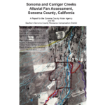
The purpose of this assessment was to analyze the current mainstem channel conditions, causes of channel avulsion and instability, and to identify potential sites of future concern along Carriger and Sonoma Creeks on their alluvial fans.
Petaluma River Watershed
Petaluma Valley Historical Hydrology and Ecology Study
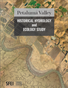
2018. Petaluma Valley Historical Hydrology and Ecology Study. SFEI Contribution No. 861. San Francisco Estuary Institute: Richmond, CA.
This study reconstructs the historical landscape of the Petaluma River watershed and documents the major landscape changes that have taken place within the watershed over the past two centuries. Prior to Spanish and American settlement of the region, the Petaluma River watershed supported a dynamic and interconnected network of streams, riparian forests, freshwater wetlands, and tidal marshes. These habitats were utilized by a wide range of plant and animal species, including a number of species that are today listed as threatened or endangered such as Ridgway’s Rail, Black Rail, salt marsh harvest mouse, California red-legged frog, Central California Coast steelhead, and soft bird’s beak (CNDDB 2012, SRCD 2015). Agricultural and urban development beginning in the mid-1800s has significantly altered the landscape, degrading habitat for fish and wildlife and contributing to contemporary management challenges such as flooding, pollutant loading, erosion, and sedimentation. While many natural areas and remnant wetlands still exist throughout the watershed—most notably the Petaluma Marsh—their ecological function is in many cases seriously impaired and their long-term fate jeopardized by climate change and other stressors. Multi-benefit wetland restoration strategies, guided by a thorough understanding of landscape history, can simultaneously address a range of chronic management issues while improving the ecological health of the watershed, making it a better place to live for both people and wildlife.

This project has been funded wholly or in part by the United States Environmental Protection Agency under assistance agreement 99T34001 to Sonoma RCD. The contents of this document do not necessarily reflect the views and policies of the Environmental Protection Agency, nor does the EPA endorse trade names or recommend the use of commercial products mentioned in this document.
Petaluma Watershed Enhancement Plan
The overall purpose of the Watershed Enhancement Plan is to identify ways in which to protect, conserve, and enhance the watershed. The draft watershed plan goals that are listed here are an expansion of the 1998 plan goals. View & Download PDF
The latest update to the Petaluma River Watershed Enhancement Plan is being finalilzed and will be posted soon. Please see the Petaluma Watershed Action Plan linked below, the supplement to the larger plan:
Petaluma Watershed Action Plan – Final Version (Sept 2022)
Including the Top Ten Identified Projects to be Implemented by the Petaluma Watershed Collaborative
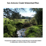
San Antonio Creek Watershed Plan
Russian River Watershed
The Russian River Coho Water Resources Partnership: Lessons learned for streamflow enhancement in California
View & Download PDF | View flipbook here on Issuu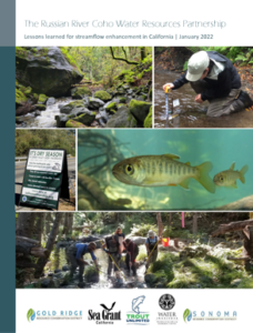
The purpose of this report is to summarize the lessons learned by the Russian River Coho Water Resources Partnership (Partnership) and its many partners through more than a decade of work on streamflow restoration in the Russian River watershed (Sonoma County, California). Our goals are to describe the reasons we think the Partnership has been successful in a way that allows our experiences to be transferable, and to provide our perspective on conditions that will facilitate future instream flow enhancement on the California coast.
The report is a companion to a second publication, The Russian River Coho Water Resources Partnership: Dedicated to improving water reliability for fish and people (2022), which summarizes the Partnership’s specific activities and accomplishments. (Continued).
The Russian River Coho Water Resources Partnership: Pioneering positive change through collaboration
View & Download PDF | View flipbook here on Issuu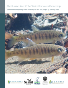
The Russian River Coho Water Resources Partnership is a collaboration of experts dedicated to improving water reliability for fish and people. A motivated group of watershed restoration practitioners, water rights specialists, and scientists formed the Russian River Coho Water Resources Partnership (Partnership) in 2009 with funding from the National Fish and Wildlife Foundation and Sonoma Water. Our goal is to increase streamflow in salmon-bearing streams, while improving long-term water security for local communities.
The experience of working collaboratively in dynamic, complex natural and social systems for over a decade has allowed us to develop the enduring relationships, innovative approaches, and adaptive strategies required to work effectively to reduce impacts to streamflow in the face of increasing climate volatility.
Stewardship Guide for the Russian River
View & Download PDF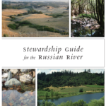
This guide, created by the Sonoma, Gold Ridge, and Mendocino County RCDs, provides an overview of the diverse Russian River Watershed, and offers a host of resources to assist with stewardship of creek-side properties throughout the Watershed.
Mark West Creek Flow Availability Analysis 2017-2020
View and Download PDF Mark West Creek Flow Availability Analysis Final Report
Mark West Flow Study Highlights
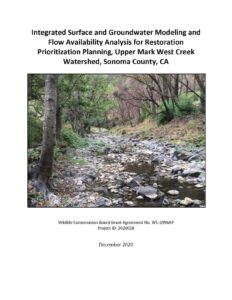
Project Introduction
The Mark West Creek watershed provides critical habitat for threatened and endangered anadromous fish and was recently identified in the California Water Action Plan as one of five streams statewide for targeted flow enhancement efforts. Effective implementation of a flow enhancement program requires a detailed understanding of the natural and man-made controls on spring and summer streamflows. The primary goal of this project is to provide a comprehensive analysis of streamflow conditions and the relative effectiveness of various potential flow enhancement actions in upper Mark West Creek watershed relative to salmonid habitat requirements. The project provides a framework for prioritizing restoration efforts and developing effective strategies and projects to protect and enhance streamflows.
This study evaluates the upper 40 mi2 of Mark West Creek watershed upstream of the Santa Rosa Plain (Figure E1) identified as critical salmonid summer rearing habitat in the State Water Resources Control Board Emergency Order WR 2015-0026-DWR. The study was conducted over a three year period and was completed by the Coast Range Watershed Institute (CRWI) in cooperation with the Sonoma Resource Conservation District (SRCD), O’Connor Environmental, Inc., Friends of Mark West Creek, Sonoma County Regional Parks, and the Pepperwood Foundation. Funding for the project was provided by a Streamflow Enhancement Program grant from the California Wildlife Conservation Board (WCB).
Maacama and Upper Mark West Creek Integrated Watershed Management Plan
The Maacama and Upper Mark West watersheds are located in central Sonoma County approximately 60 miles north of San Francisco and lie to the east of the Highway 101 corridor.
Both the Maacama and Upper Mark West watersheds are bordered by the Mayacamas mountain range and the Napa County line to the east. The Maacama Watershed is bordered by Alexander Valley to the northwest and the Upper Mark West watershed to the south, followed by the Laguna de Santa Rosa watershed. These watersheds are located east of the cities of Santa Rosa, Windsor, and Healdsburg.
Lower Mill Creek Surface Water and Groundwater Interactions Report 2018-2020
View and Download PDF Lower Mill Creek Surface Water and Groundwater Interactions Report 2018-2020
Project Introduction
In 2017 the Sonoma Resource Conservation District (SRCD), TU and O’Connor Environmental, Inc. (OEI) received a grant from the Wildlife Conservation Board (WCB) to investigate streamflow conditions in the lower reach of Mill Creek, and to develop a comprehensive integrated hydrologic model of the Mill Creek watershed. The surface water/groundwater monitoring study in the lower reach of Mill Creek involves groundwater and surface water data collection to investigate the relationship between surface flow and groundwater conditions to determine whether streamflow enhancement projects can increase streamflow to benefit habitat for over-summering juvenile salmonids in this reach. This report describes the results of TU’s three years of monitoring.
Mill Creek Flow Availability Analysis
View & Download PDF Mill Creek Flow Availability Analysis
Project Introduction
The Mill Creek watershed provides some of the best remaining habitat for coho salmon (Oncorhynchus kisutch) in the Russian River watershed, however several factors have been identified as limiting for coho survival including insufficient high quality pool habitat, winter refugia, and spring/summer baseflows. Numerous habitat restoration projects have been implemented in the watershed in recent years aimed primarily at improving pool habitat and removing passage barriers. Additional efforts have begun to address the problem of insufficient stream flow primarily through water storage and flow release projects. Successful efforts to improve streamflow requires greater understanding of the spatial and temporal distribution of flow and the various natural and man-made controls on these flows.
This project facilitates this improved understanding by developing and calibrating a distributed hydrologic model to describe existing conditions in the watershed relative to salmonid habitat requirements and to develop habitat restoration priorities for the watershed. The model also serves as a decision support tool for watershed restoration efforts by evaluating the effectiveness of various potential streamflow improvement strategies and quantifying the expected changes in hydrologic conditions due to ongoing global climate change. The project was completed by O’Connor Environmental, Inc. under the direction of the Coast Range Watershed Institute in cooperation with the Sonoma Resource Conservation District and Trout Unlimited. Funding for the project was provided by a Proposition 1 Streamflow Enhancement Program grant from the California Wildlife Conservation Board.
Mill Creek Watershed Management Plan
Mill Creek watershed is located within the Russian River watershed Hydrologic Unit and the Warm Springs Hydrologic Sub-Basin as classified by Cal-Watershed 2.2a. The Warm Springs sub-basin runs along the western edge of the Russian River basin in Sonoma County and contains the vast expanse of the Dry Creek watershed and Lake Sonoma, which now occupies the majority of the sub-basin watershed. This sub-basin is named after Warm Springs Dam, constructed in 1982, which impounds Lake Sonoma. Primary ownership throughout the sub-basin is private, although USACE owns and manages Lake Sonoma.
Water Quality Trading Framework for the Laguna de Santa Rosa Watershed, California
Water Quality Trading Framework for the Laguna de Santa Rosa Watershed, California
Water Quality Credit Trading is an innovative approach to achieve water quality goals and regulatory requirements by the purchase of pollution reduction “credits” from other sources, including water quality management practices on agricultural lands. The RCD, in collaboration with consultants, partners and local agricultural landowners, is working on the development of this first trading market in California in the Laguna de Santa Rosa Watershed. In the program, agriculture provides nutrient credits through implemented conservation practices for a wastewater treatment plant buyer and will serve as a template transferable to other watersheds in California.
Austin Creek Watershed Assessment
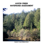
Austin Creek is a major tributary to the Russian River. This watershed assessment reviews erosion sources in the watershed, the current and historic condition of the creek channel and watershed, the extent of riparian forest, water quality and temperature conditions, and land uses. The goal of the watershed assessment is to investigate a broad range of current and historic conditions in the watershed and creek and recommend enhancement projects and Best Management Practices (BMPs) to improve water quality and creek habitat conditions.
Copeland Creek Watershed Assessment
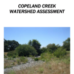
Copeland Creek is a small tributary in the southeastern corner of the Russian River watershed. The City of Rohnert Park occupies the downstream half of the drainage where the creek is primarily a straightened flood control channel. Copeland Creek is a tributary of the Laguna de Santa Rosa. The upstream half of the watershed is rural and the creek is a natural channel.
This watershed assessment reviews erosion sources in the watershed, the current and historic condition of the creek channel and watershed, the extent of riparian forest, water quality and temperature conditions, and land uses. The goal of the watershed assessment is to investigate a broad range of current and historic conditions in the watershed and creek and recommend enhancement projects and Best Management Practices (BMPs) to improve water quality and creek habitat conditions.